Aircraft Program - US Coast Guard Collaboration: Alaska (ACG)
The CCGG Aircraft Group has been collaborating with the U.S. Coast Guard on a special project in Alaska. A Coast Guard Hercules C-130 aircraft conducts biweekly missions as part of their Arctic Domain Awareness mission, usually flying from Air Station Kodiak up to Barrow and back.
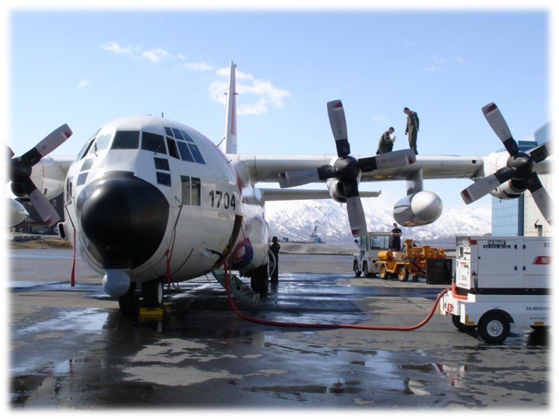
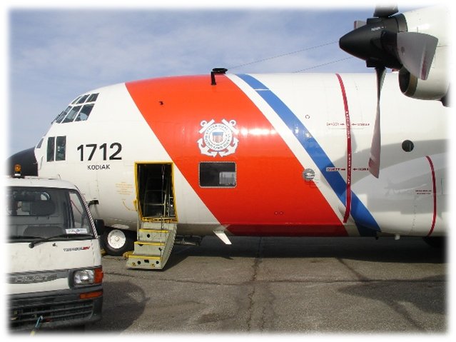
The Aircraft Group has installed flask packages, a continuous CO2/CH4/H2O analyzer (Picarro), and a continuous ozone monitor (2B Systems) on board this aircraft. A window has been replaced with a specially manufactured inlet window for our instrumentation, and three of NOAA's calibrated CO2/CH4 standards are also on board for calibration of the in-situ continuous analyzer.

The inlet for the NOAA sampling system is installed as a replacement window plate. The plate includes three dedicated inlets for ozone, continuous CO2/CH4, and flask samples, as well as a Vaisala HMP-50 temperature and relative humidity sensor.
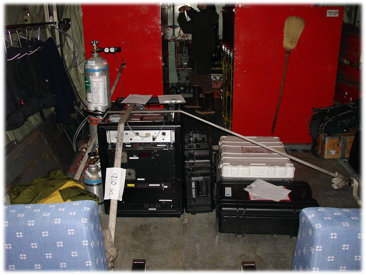
Below is a photograph of the interior of the HC-130 aircraft with NOAA equipment on board. Three tanks containing CO2/CH4 standards (two short, one tall) are mounted to the left side of the rack. The rack contains a control box, the Picarro CRDS CO2/CH4/H2O continuous analyzer, a 2B ozone analyzer, and a rack-mounted compressor package (PCP) to fill flasks. The Programmable Flask Packages (PFPs, or 12-packs) are the black suitcases to the right of the rack. Other equipment suitcases are farther to the right.
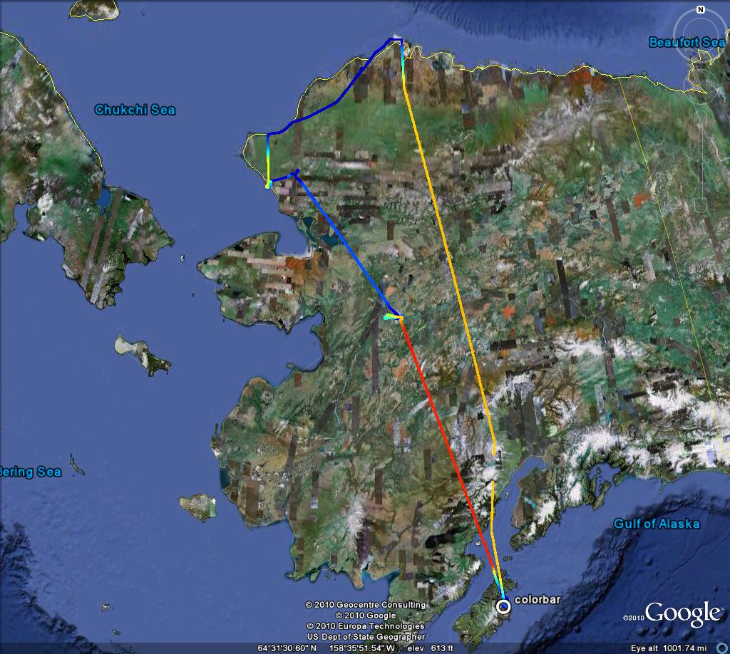
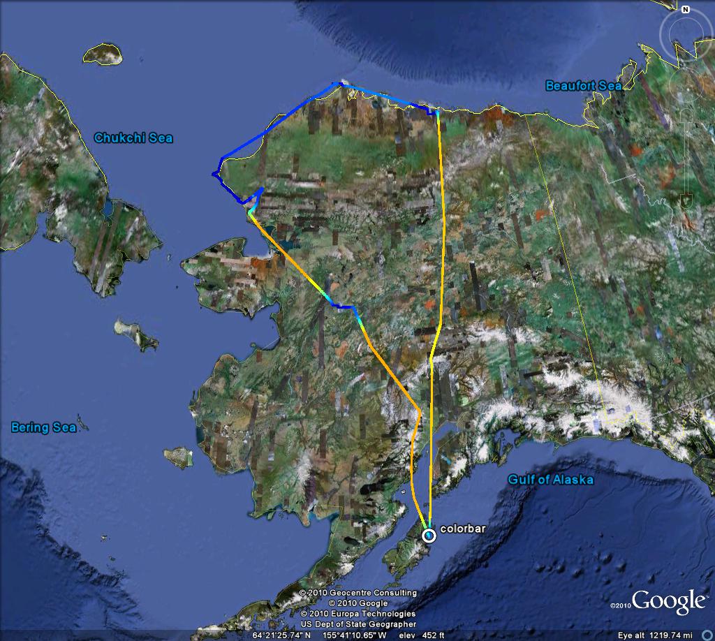
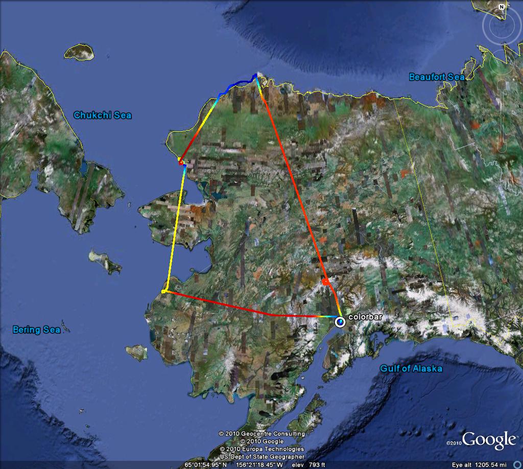
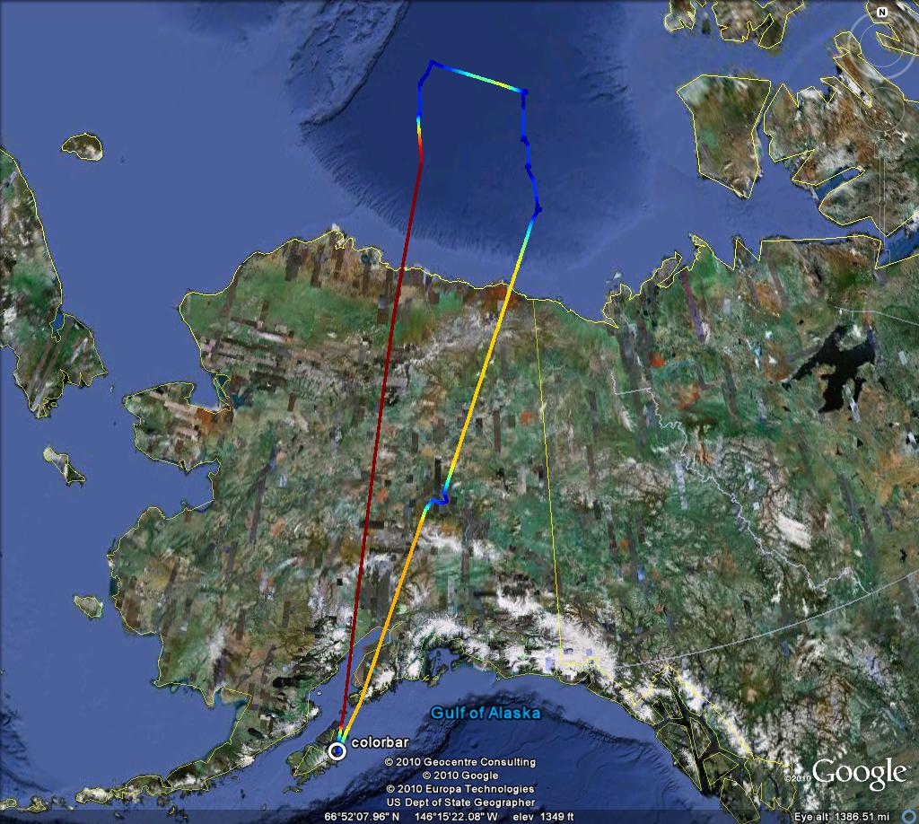
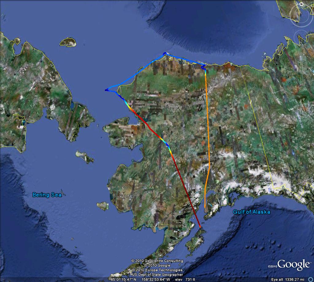
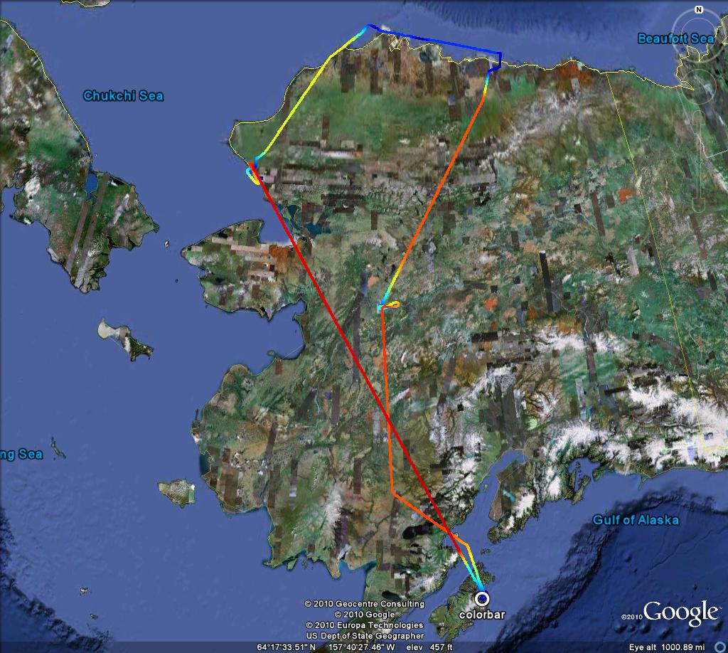
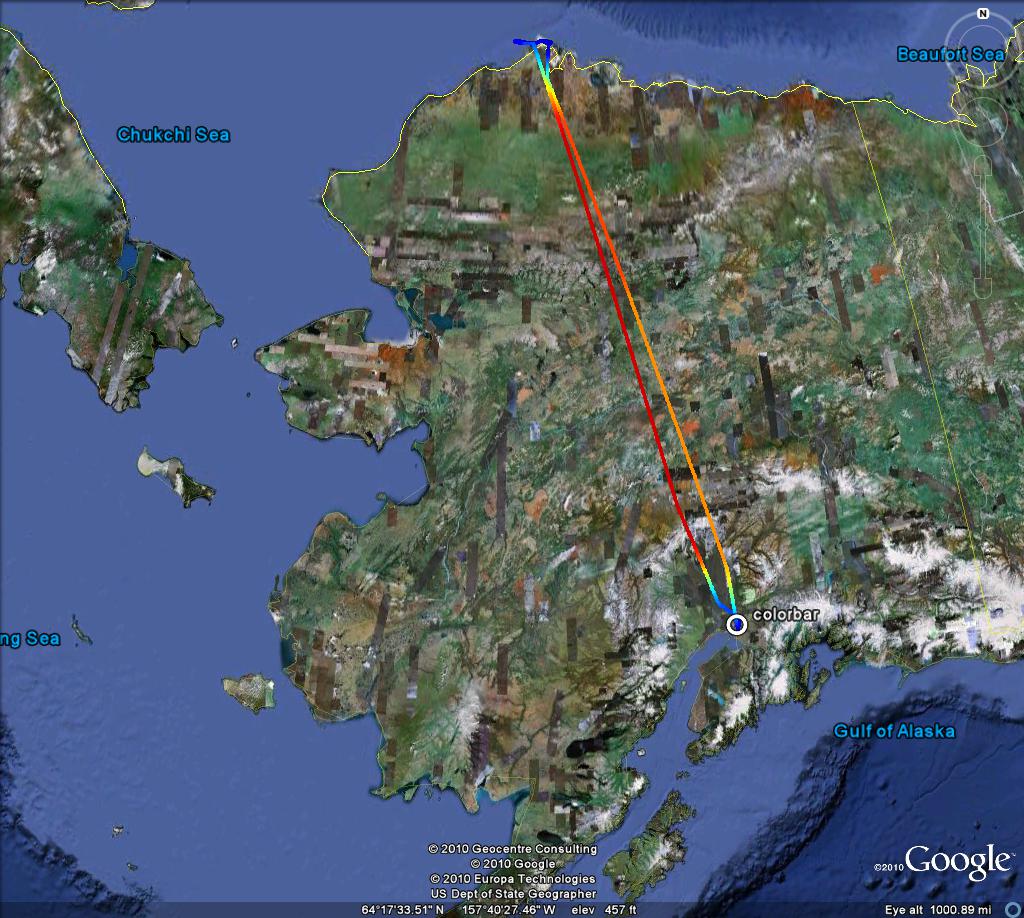
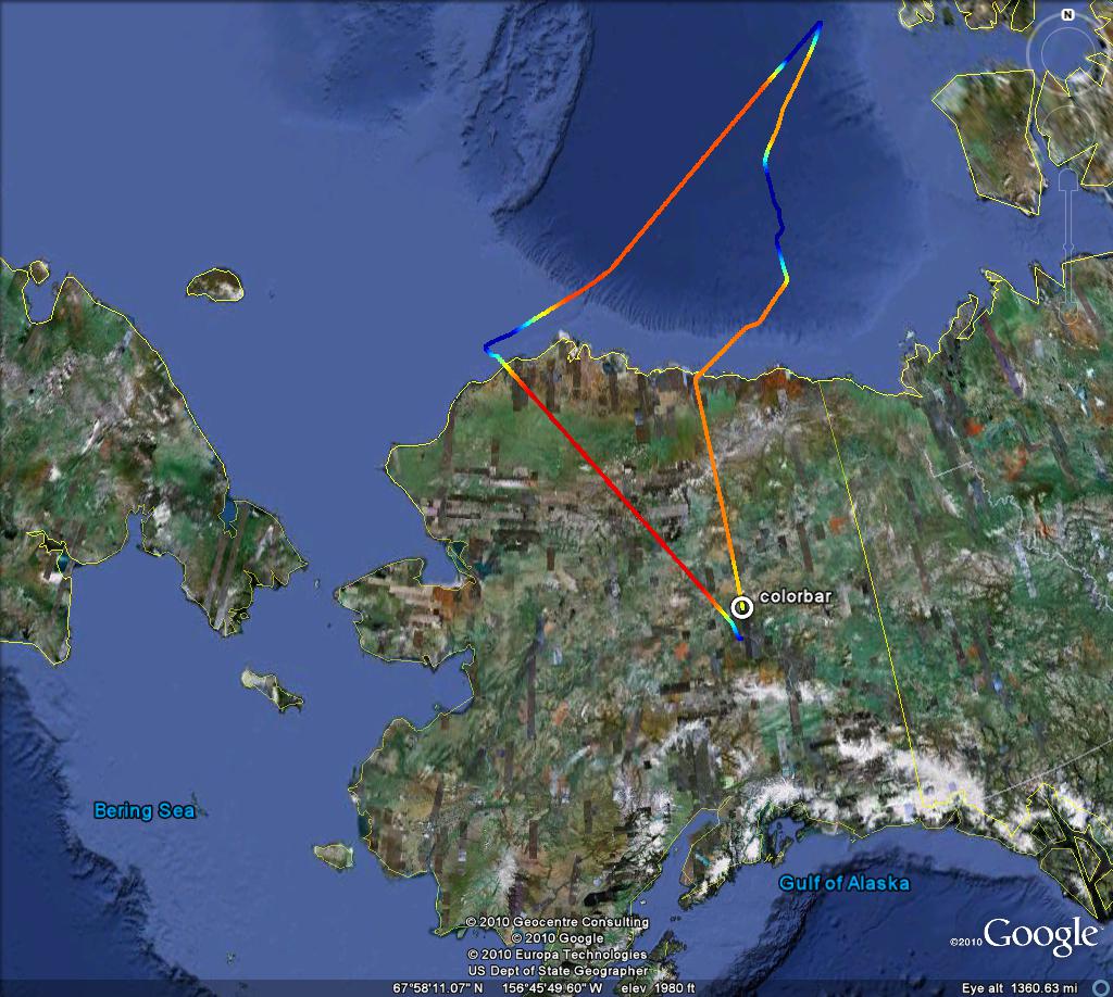
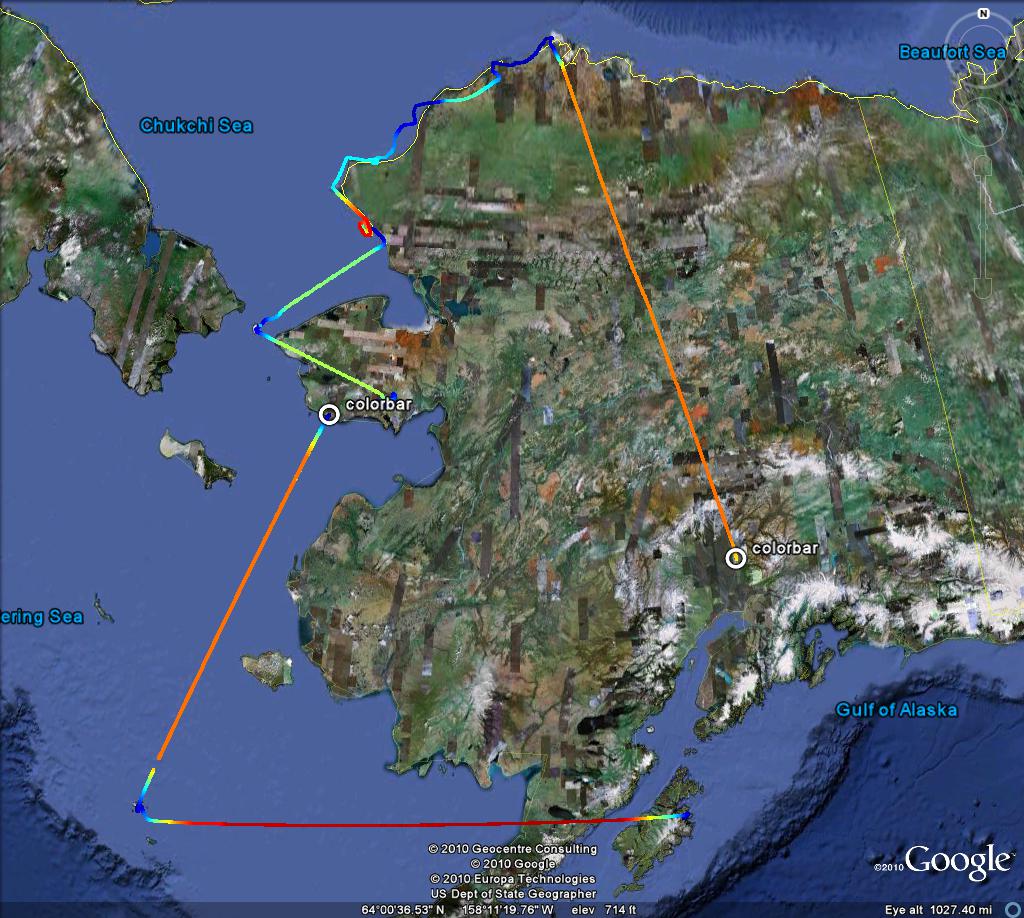
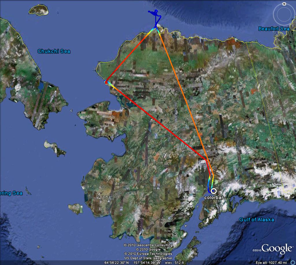
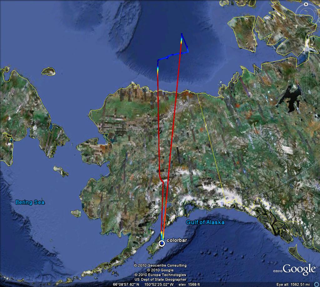
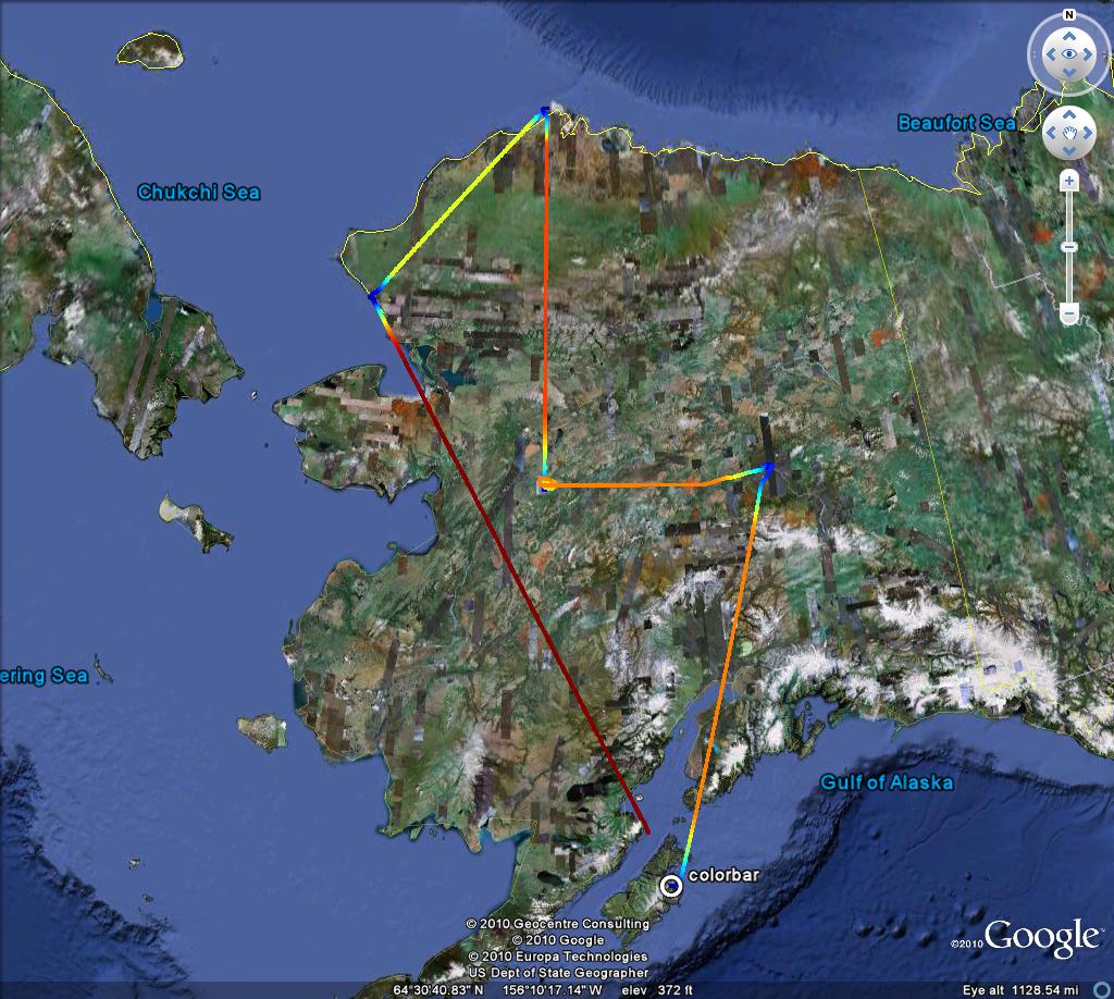
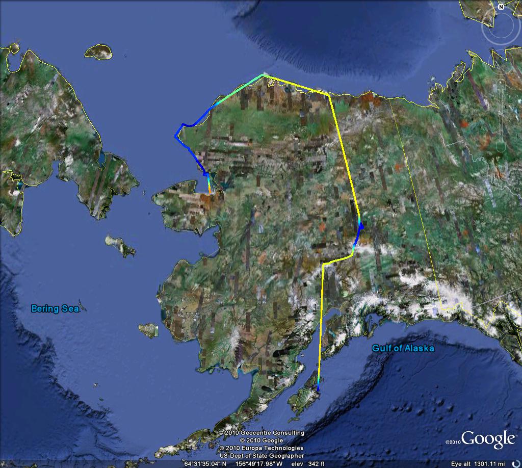
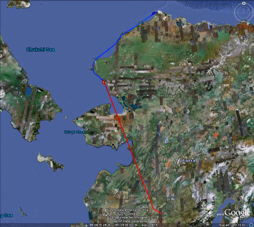
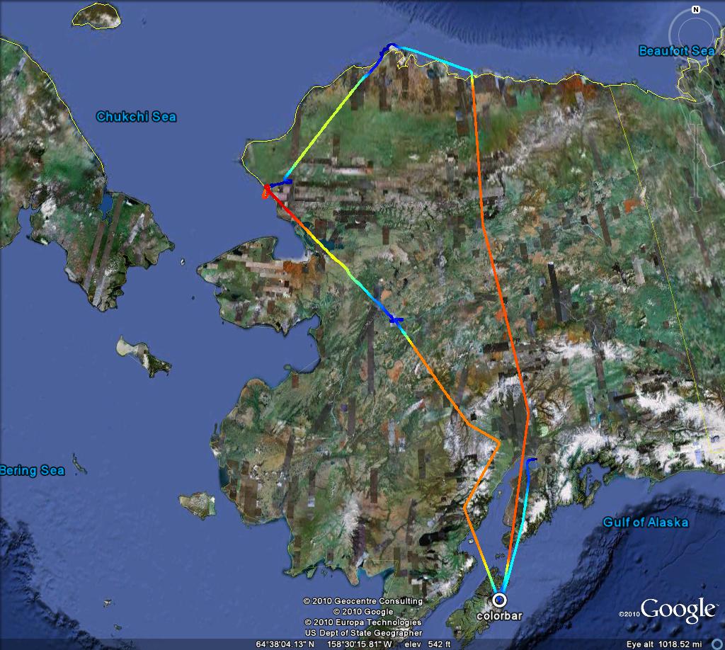
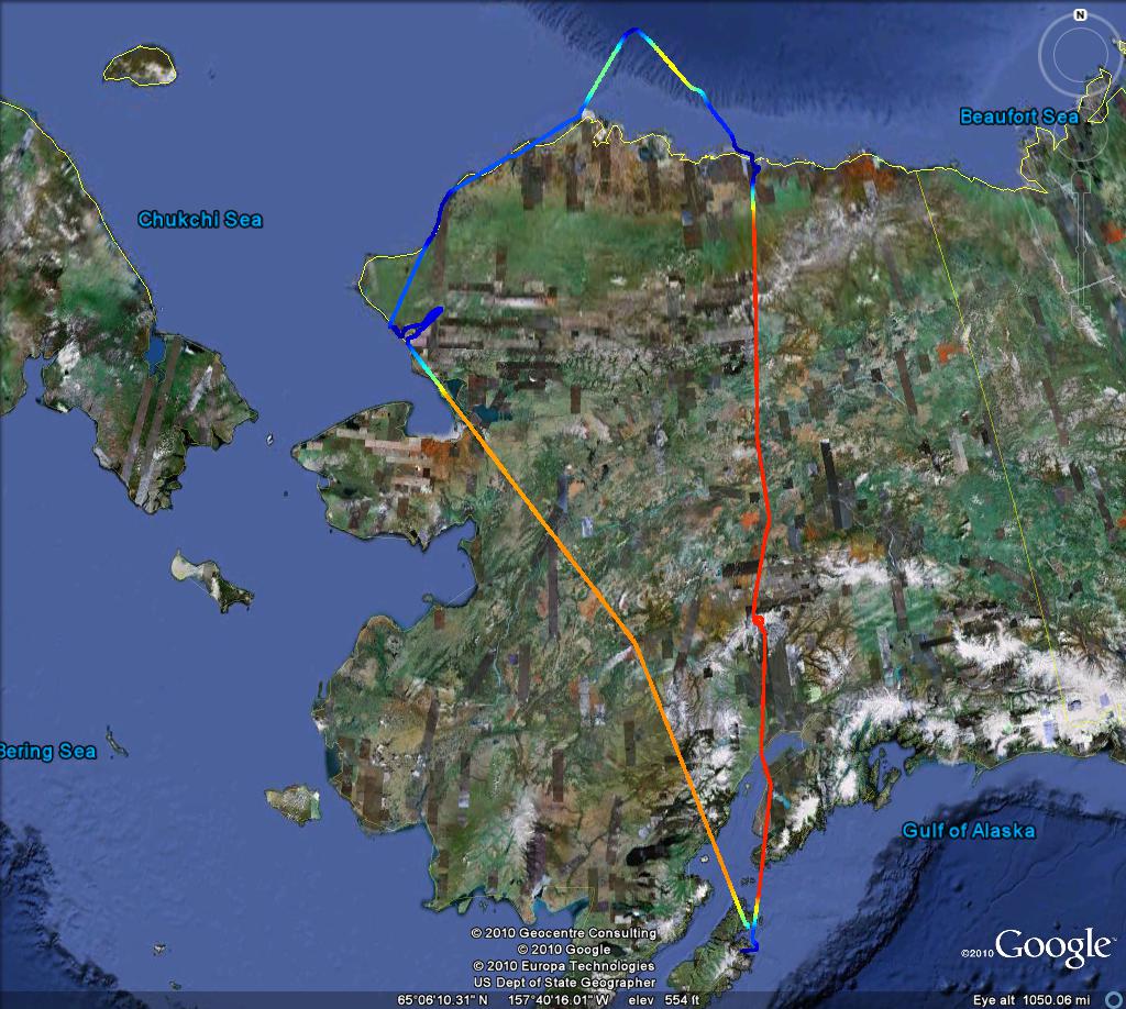
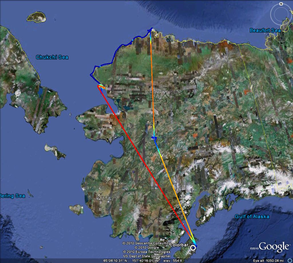
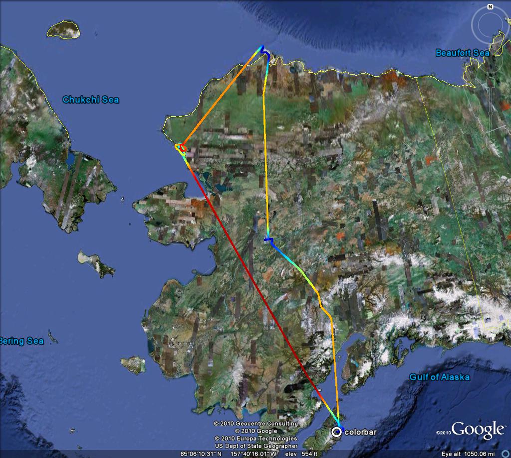
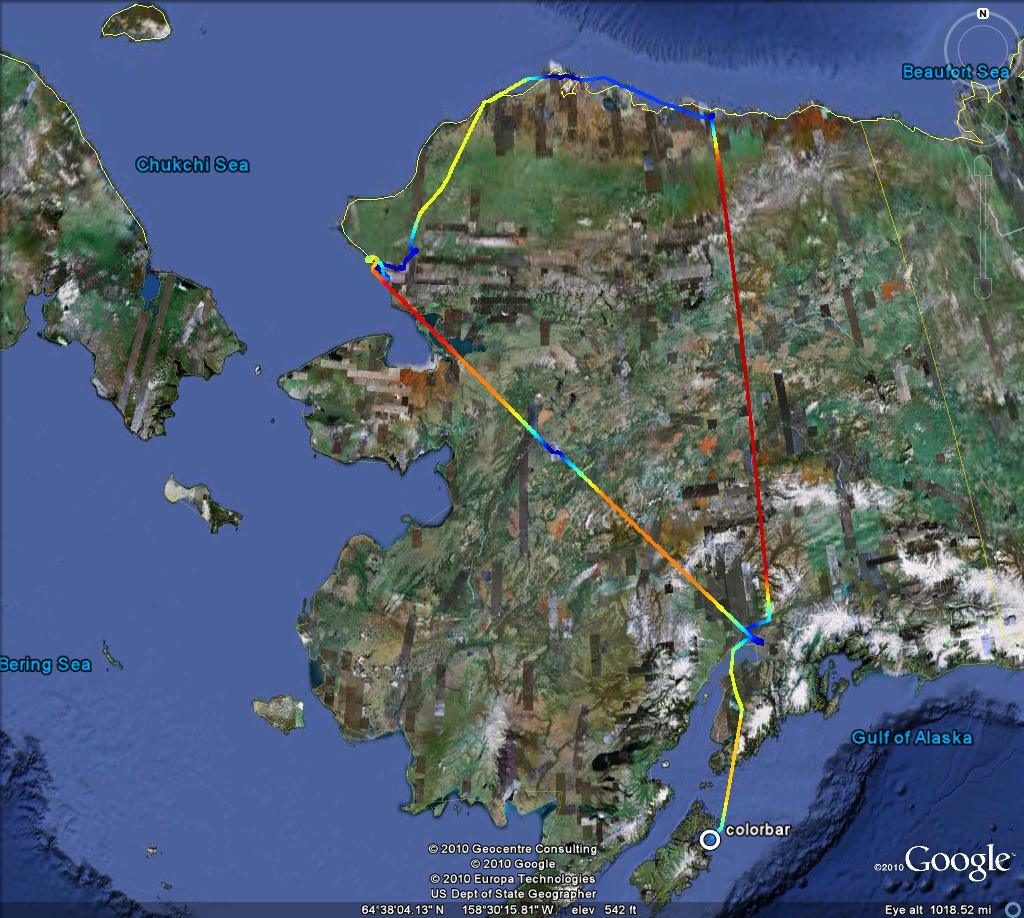
Flights generally depart from Kodiak in the south, perform an altitude profile over Galena just south of the Brooks Range, descend again to low altitude over Kivalina on the coast, continue at low altitude to Barrow, and then (sometimes) continue over Prudhoe Bay before returning at cruising altitude back to Kodiak.
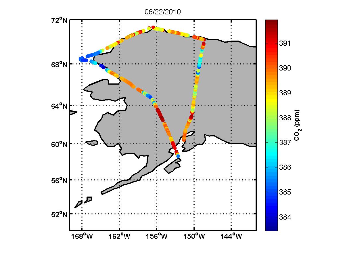
Google Earth Flight Tracks
To download KMZ files showing the flight track for each flight for viewing in Google Earth, click on the appropriate date below. Click on the image to see the full size image of the flight track. Flight paths are color-coded by altitude (red to blue = high to low, from 8500 masl to zero).